Click on Map to Enlarge
Maps to Tyler State Park Camp Meeting
Click on Map to Enlarge
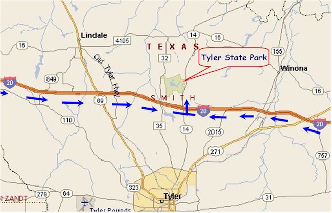
DIRECTIONS TO TYLER STATE PARK
From Dallas or points West of Tyler: Take I-20
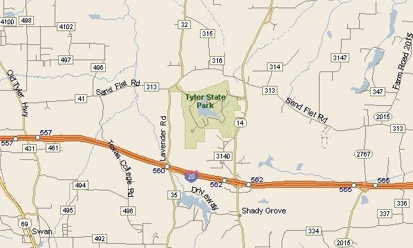
east to about 6 miles east of State Hwy 69 to F.M. 14. Exit and turn left (north)
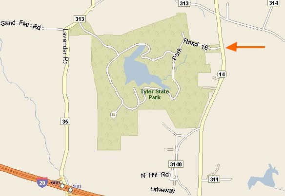
onto F.M. 14. Go about two miles to the Tyler State Park entrance. Turn left
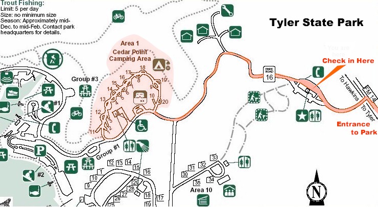
into the park and follow map to the Cedar Point Camping Area.
From Shreveport or points East of Tyler: Take I–20 west to F.M. 14. Exit and
turn right (north) onto F.M. 14 and go about two miles to the Tyler State Park
entrance. Turn left into the park and follow the map to the Cedar Point Camping
Area.